Explore Haa’s pristine, untouched beauty by traversing trails that are just beginning to gain visitors- abundant biodiversity and stunning landscapes await you. From the serene hillsides to challenging mountain paths, our trails cater to all levels of hikers.
1. Nubtshonapata
Total Distance : 21.3km
Time: 5 Days, 4 nights
Altitude Range: 3278m to 4200m
Starting Point: Kajena Village
Ending Point: Kajena Village
Also known as the Poppy Trek, Nubtshonapata offers a unique opportunity to explore the habitat of the elusive Snow leopard and endemic white poppy with diverse flora and fauna which covers 21.3 km from Haa, Dranadingkha. Hidden in the folds of the Himalayas, Nubtshonapata Lake is considered sacred by Bhutanese people. Historically, the trek dates back to the biography of Terton Sherab Mebar (religious treasure revealer) and the mythical breed of cattle “Nublang”. With an average walking time of 6-7 hours per day, hikers camp each night.
2. Sagala trek
Total Distance : 26km
Max Altitude : 4350m
Hike Duration : 3 days
Starting Point: Chelela, Haa
Ending Point: Drukgyel Dzong, Paro
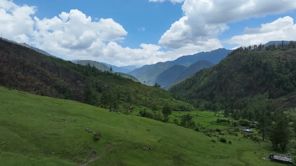
The Sagala Trek combines an in-depth appreciation of the country‟s cultural attractions with a moderate to strenuous two days trek along a mountain ridge dividing the Paro and Haa Valleys of western Bhutan. Known as “Twin valley trekking route or Sagala Trek” is located between two dzongkhags, Haa and Paro. The trekking route of 22.68 km from Chelela till Talung village provides immense potential of scenic beauty and one of the main highlights of the trek is the absolutely gorgeous 360-degree view from the Pass with Mount Jhomolhari, Kangchenjunga, Haa valley and Paro valley along with diverse flora and fauna diversity. This trek offers scenic panoramic vistas of sacred Jomolhari and other Himalayan peaks plus views of the valleys themselves. Your trek begins from the Haa Valley (2726m) through a paved motor road till Chelela in less than an hour. Taking the trail along the ridgeline, you will climb up gradually, then descend through alpine meadows and rhododendron.
3. Haa Panorama Trail
Total Distance : 11km
Max Altitude : 3,150m
Hike Duration : 5-6 hours
Starting Point: Yangthang Monastery
Ending Point: Wangtsa village
Overlooking a splendid view of Haa valley and four major Goempa’s in upper Haa, passing through Juneydrak and Katsho Goempa. Get the best view of the three Meri Puensum peaks while meandering through a well kept trail close to Haa Town. This 11-kilometer, 6-hour well marked hike goes through pine forests and has a maximum elevation of 3150 meters. The trail begins from Yangthang Monastery and ends at Wangtsa village. Enjoy a mid-hike lunch at the pastures of Katsho Eco Camp or under a canopy after the first segment.
4. Meri Puensum Trail
Commencing at Dumcho, a 10 minute drive from the center of Haa Town, the Meri Puensum hike explores the three most famous peaks of the valley. The Meri Puensum Heritage Forest, an area of 563 hectares, was established in 2016. The hiking trail was inaugurated in commemoration of the 60th birthday of His Majesty the Fourth King of Bhutan. You will ascend uphill for about 4-5 hours and reach the grand view point where you can see magnificent views of Mount Jomolhari and Chelela pass. Begin by lighting incense at Lhakang Karpo in Dumcho before embarking, and look forward to three different canopy rest stops along the way. Taking a total of 8-9 hours, the trail ends at the suspension bridge near Haa Town.
Total Distance : 27 km
Max Altitude : 3,800m
Hike Duration : 8-9 hours
Starting Point: Dumcho
Ending Point: Suspension bridge, Haa Town
5. Red Panda Trek (Haa-Tergola-Gakiling)
The Haa Red Panda Trek is located under Gakiling gewog, Sangbaykha Dungkhag, with an altitudinal range from 3700m to 800m with diverse flora and fauna. One can have direct sightings of red pandas along the trek and overnight at Gakiling you can visit the popular spot for pilgrims, Rangtse Nye. The trek starts from Jilam (Red Panda Trek Start Point) at 3487m and is 14.62 km until Legoten road point. Highly sought after by explorers, naturalists and scholars and popular among tourists, the shy, charismatic and endangered Red Panda can be found along this trail. It is said that sightings of the Red Panda bring good luck!
Total Distance : 14.62 km
Max Altitude : 3487mHike Duration : 10 hours
Starting Point: Jilam
End Point: Legoten road point
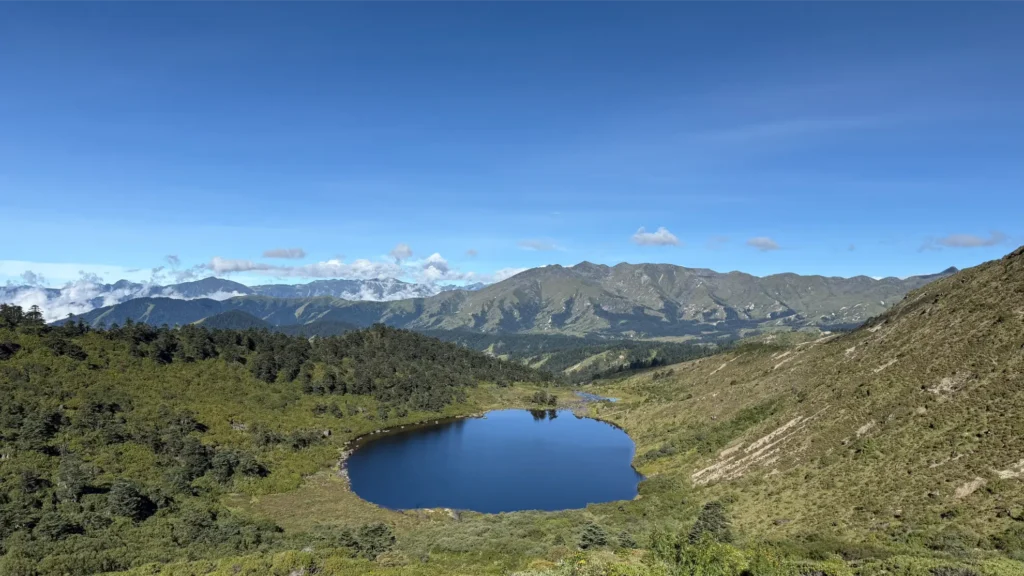
6. Jobay Tsho Trek- The Hidden Lake
Nestled within the picturesque landscapes of Sangbaykha Dungkhag under Haa Dzongkhag, the Eco Trail of Jo Bay Tsho, also known as “The Hidden Lake”, promises an unforgettable journey through thick broadleaved forests, stunning ridges, and serene meadows. This trail, rich in biodiversity and natural beauty, offers a glimpse into the hidden treasures of Bhutan’s wilderness. A 75 km car drive from Haa would deliver you first to Amochu bridge, and yet another 20 km drive will reach Mochu Lhakhang. Before beginning to walk, visit the Lhakhang to receive blessings from 1,000 statues of Guru Rinpoche.
After 30 km along the ridge, you will finally arrive at your destination: Jo Bay Tsho, “The Hidden Lake” which is a stunning, high altitude lake nestled in a serene valley surrounded by gentle slopes and Fir and Rhododendron Forest. Spend the night here and embark on the return trek on day 2, taking you through rhododendron and bamboo forests, along the ridge line of Youkha, and culminating with a stunning view from the Shetobir Rocky Cliff. The trek ends at Youkha village.
Total Distance : 25 kilometers
Hike Duration : 2 days
Starting Point: Mochu
Ending Point: Youkha